
 15 Topics
 0 Days
 60 Sessions
Programme Overview
Training Description
M&E Officers/Managers
Project Managers
GIS Specialists and Analysts
Data Scientists and Analysts
Development Practitioners
Government Officials in Planning and Monitoring
NGOs and International Organizations Staff
Individuals looking to incorporate spatial data collection and GIS tools into their M&E work will greatly benefit from this course.
Session Objectives
- Understand the Role of Spatial Data in M&E Learn the importance of spatial data in project monitoring and how it enhances decision-making and resource allocation. Master Data Collection Techniques Gain hands-on experience with tools and methods for collecting spatial data (e.g., GPS devices, mobile apps, satellite imagery). Manage Geospatial Data Efficiently Develop skills in organizing, storing, and managing geospatial data for M&E projects, ensuring easy access and integrity. Implement GIS Software for Data Analysis Learn how to use GIS platforms such as ArcGIS, QGIS, and other geospatial tools for analysis and visualization of spatial data. Analyze Spatial Data for M&E Insights Apply spatial analysis techniques to assess program performance, identify trends, and evaluate impacts geographically. Integrate Spatial Data with Traditional M&E Metrics Understand how to combine geospatial data with other M&E metrics for comprehensive, multi-dimensional evaluations. Utilize Mapping and Visualization Techniques Learn to create maps and other visual representations to present spatial data effectively to stakeholders. Ensure Data Quality and Accuracy Understand data validation, accuracy checks, and quality control in spatial data collection and management. Apply GIS Tools to Support Project Planning and Impact Assessment Use GIS for project planning, progress tracking, and assessing the spatial impacts of M&E activities. Understand Legal and Ethical Considerations in Spatial Data Learn about the privacy, confidentiality, and ethical concerns related to spatial data collection in M&E projects. This course will empower professionals to elevate their M&E projects through the effective use of spatial data, enhancing their capability to monitor, evaluate, and report with greater precision and spatial awareness. Spatial Data Collection & Management for M&E Projects offers a comprehensive foundation for professionals aiming to adopt GIS and spatial data in their projects for improved impact measurement and decision-making.
About the Course
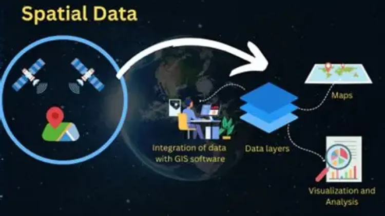
In the modern world of Monitoring and Evaluation (M&E) projects, spatial data collection and management has become an indispensable tool for tracking progress, assessing impacts, and making informed decisions. The integration of Geographic Information Systems (GIS) and spatial data techniques into M&E projects enhances the ability to visualize and analyze the geographic dimension of data, enabling more effective program management and policy implementation. This Spatial Data Collection & Management for M&E Projects training course is designed to equip professionals with the skills and knowledge required to collect, manage, and analyze spatial data within the context of M&E, ensuring a higher level of project effectiveness and impact measurement.
Participants will gain an in-depth understanding of tools, techniques, and best practices for incorporating spatial data in M&E projects, from data collection and entry to advanced spatial analysis. This course is tailored to those seeking to enhance their M&E processes with GIS technology, which is critical for managing and evaluating development, environmental, and humanitarian projects.
Curriculum & Topics
15 Topics | 60 Sessions
-
 Workshop 1.1:
Understanding the Role of Spatial Data in M&E
-
Workshop 1.2:
Key Concepts: GIS, Remote Sensing, and Spatial Data Types
-
Workshop 1.3:
Applications of Spatial Data in Project Monitoring and Evaluation
-
Workshop 1.4:
How Spatial Data Enhances Project Planning and Impact AssessmentModule 2: Data Collection Techniques for Spatial Data
-
Workshop 2.1:
N/A
-
Workshop 2.2:
N/A
-
Workshop 2.3:
N/A
-
Workshop 2.4:
N/A
-
Workshop 3.1:
Data Organization Strategies: Structuring and Storing Spatial Data
-
Workshop 3.2:
Best Practices for Data Integrity and Accuracy
-
Workshop 3.3:
Creating and Managing Spatial Data Repositories
-
Workshop 3.4:
Key Tools for Effective Data Management in M&E Projects
-
Workshop 4.1:
Overview of GIS Tools: ArcGIS, QGIS, and Google Earth Engine
-
Workshop 4.2:
Choosing the Right GIS Software for Your M&E Project
-
Workshop 4.3:
Essential GIS Functions: Mapping, Data Layering, and Analysis
-
Workshop 4.4:
Hands-On Exercise: Exploring GIS Software for M&E
-
Workshop 5.1:
Types of Remote Sensing Data for Monitoring and Evaluation
-
Workshop 5.2:
Using Satellite Imagery and Aerial Data for Impact Analysis
-
Workshop 5.3:
Combining GIS and Remote Sensing Data for Comprehensive Insights
-
Workshop 5.4:
Practical Applications: Remote Sensing in Environmental and Social Projects
-
Workshop 6.1:
Preprocessing Spatial Data for Accuracy and Clarity
-
Workshop 6.2:
Geo-Referencing and Aligning Spatial Data for Consistency
-
Workshop 6.3:
Digitizing Data and Converting Between Formats
-
Workshop 6.4:
Data Cleaning and Quality Control for Spatial Accuracy
-
Workshop 7.1:
Spatial Analysis Tools: Buffering, Overlay, and Proximity Analysis
-
Workshop 7.2:
Quantitative and Qualitative Analysis of Spatial Data
-
Workshop 7.3:
Detecting Patterns and Trends in Geospatial Data
-
Workshop 7.4:
Hands-On Exercises: Advanced GIS Analysis Techniques
-
Workshop 8.1:
Designing and Creating Effective Maps for Reporting
-
Workshop 8.2:
Visualizing Data: Thematic and Story Maps
-
Workshop 8.3:
Spatial Visualization Techniques for Data Communication
-
Workshop 8.4:
Interactive Map Design Using GIS Tools
-
Workshop 9.1:
Combining Spatial and Non-Spatial Data for Insights
-
Workshop 9.2:
Using GIS to Monitor Project KPIs and Indicators
-
Workshop 9.3:
Real-Time GIS Monitoring for Ongoing Project Evaluation
-
Workshop 9.4:
Visualizing and Reporting M&E Data with GIS Integration
-
Workshop 10.1:
Spatial Tools for Project Planning and Site Selection
-
Workshop 10.2:
Mapping Resource Distribution for Efficient Allocation
-
Workshop 10.3:
Geospatial Tools for Impact Assessment and Reporting
-
Workshop 10.4:
GIS in Resource Management and Sustainability Monitoring
-
Workshop 11.1:
Ensuring the Accuracy and Validity of Spatial Data
-
Workshop 11.2:
Methods for Data Quality Assurance and Control
-
Workshop 11.3:
Handling Missing, Incomplete, or Inaccurate Data
-
Workshop 11.4:
Data Validation Techniques to Enhance Reliability
-
Workshop 12.1:
Ethical Standards for Spatial Data Collection
-
Workshop 12.2:
Understanding Legal Regulations: Privacy, Data Protection, and Security
-
Workshop 12.3:
Managing Sensitive Geospatial Data Responsibly
-
Workshop 12.4:
Ensuring Compliance with Local and International Laws
-
Workshop 13.1:
Designing Clear, Concise, and Impactful Spatial Reports
-
Workshop 13.2:
Creating Dashboards and Interactive Visualizations for Stakeholders
-
Workshop 13.3:
Effective Presentation of Spatial Data Insights
-
Workshop 13.4:
Hands-On Exercise: Building a GIS-Based Report
-
Workshop 14.1:
Spatial Impact Analysis: Measuring Project Effectiveness
-
Workshop 14.2:
Using GIS to Track Project Progress and Outcomes
-
Workshop 14.3:
Analyzing Geospatial Data to Identify Trends and Gaps
-
Workshop 14.4:
Real-Life Case Studies: GIS for Monitoring and Evaluation
-
Workshop 15.1:
Emerging GIS Technologies for M&E Projects
-
Workshop 15.2:
The Role of AI and Machine Learning in Spatial Data Analysis
-
Workshop 15.3:
Innovations in Spatial Data Collection and Visualization for M&E
-
Workshop 15.4:
Future Applications of GIS in Development Projects