
 12 Topics
 5 Days
 36 Sessions
Programme Overview
Training Description
Remote Sensing and Geospatial Data Analysis
Environmental Monitoring and Management
Agriculture and Forestry monitoring
Defense and Security
Disaster Management and Risk Mitigation
Engineering and Infrastructure management
Research and Academia in the field of geospatial sciences
Session Objectives
- Understand SAR Technology and Principles – Gain a foundational understanding of how SAR systems work, including the principles behind radar waves, signal processing, and image formation. Process SAR Data – Learn to process and analyze SAR data, including noise reduction, image calibration, and interpretation of radar signals for high-resolution images. Master SAR Image Interpretation – Develop the ability to interpret SAR images, with a focus on identifying different surface features and changes over time. Apply SAR in Various Fields – Explore the applications of SAR in environmental monitoring, disaster management, agriculture, and defense, and learn how SAR data can inform decision-making in these sectors. Analyze SAR Data for Specific Applications – Work with case studies and practical examples of SAR data applied to real-world problems such as flood monitoring, forest management, urban growth analysis, and infrastructure assessment. Utilize Advanced SAR Processing Techniques – Gain practical knowledge of advanced processing techniques such as interferometry, change detection, and 3D imaging using SAR data. Understand SAR Data Fusion – Learn how to integrate SAR data with other types of remote sensing data for enhanced analysis and decision-making. Stay Updated with Emerging SAR Trends – Stay ahead in the field by understanding the latest trends and advancements in SAR technology and its evolving applications. This course will equip participants with the necessary skills to effectively utilize SAR technology for advanced data analysis and applications across industries, preparing them for roles that involve high-level geospatial and remote sensing tasks.
About the Course
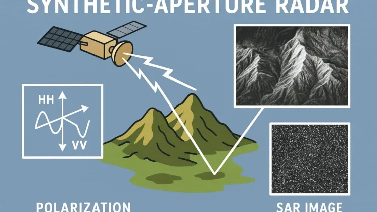
Introduction: The Synthetic Aperture Radar (SAR) Data Processing & Applications Training Course is designed to provide professionals with a deep understanding of SAR technology and its various applications. SAR is a remote sensing technology that uses radar to capture high-resolution images of the Earth's surface, even in challenging conditions like cloud cover or low light. This course covers the essentials of SAR data processing, the technology behind SAR systems, and how it is used in a wide range of applications, including environmental monitoring, disaster management, agriculture, and defense.
As SAR technology continues to evolve, its applications in Earth observation, disaster management, and other critical fields become increasingly important. This course aims to equip participants with practical skills and knowledge to harness SAR data for real-world applications.
Curriculum & Topics
12 Topics | 36 Sessions
-
 Workshop 1.1:
Overview of SAR principles and technology
Workshop 1.1:
Overview of SAR principles and technology
-
Workshop 1.2:
History and evolution of Synthetic Aperture Radar
-
Workshop 1.3:
Comparison with other remote sensing techniques (e.g., optical and LiDAR)
-
Workshop 2.1:
Understanding radar wave propagation and characteristics
-
Workshop 2.2:
Signal processing techniques for SAR data acquisition
-
Workshop 2.3:
Types of radar systems and their applications
-
Workshop 3.1:
SAR image formation principles
-
Workshop 3.2:
Image processing workflows for SAR data
-
Workshop 3.3:
Techniques for image geocoding and rectification
-
Workshop 4.1:
Methods of SAR data calibration
-
Workshop 4.2:
Noise reduction and speckle filtering
-
Workshop 4.3:
Image registration and alignment
-
Workshop 5.1:
Introduction to InSAR principles
-
Workshop 5.2:
Interferogram generation and phase unwrapping
-
Workshop 5.3:
Applications of InSAR for surface deformation monitoring
-
Workshop 6.1:
Monitoring floods, earthquakes, and landslides with SAR
-
Workshop 6.2:
SAR data for disaster response and recovery efforts
-
Workshop 6.3:
Case studies of SAR in post-disaster environments
-
Workshop 7.1:
Land cover classification using SAR data
-
Workshop 7.2:
Monitoring deforestation, agricultural land use, and coastal erosion
-
Workshop 7.3:
Applications in environmental conservation and climate change studies
-
Workshop 8.1:
Detecting crop health, soil moisture, and irrigation patterns
-
Workshop 8.2:
SAR for monitoring crop yields and agricultural productivity
-
Workshop 8.3:
SAR data applications for precision farming
-
Workshop 9.1:
Using SAR data to assess infrastructure health (e.g., bridges, dams, roads)
-
Workshop 9.2:
Monitoring urban growth and infrastructure development with SAR
-
Workshop 9.3:
Case studies of infrastructure failure monitoring
-
Workshop 10.1:
SAR interferometry and Differential SAR (DInSAR) for measuring ground displacement
-
Workshop 10.2:
3D SAR imaging and volumetric analysis
-
Workshop 10.3:
Change detection and time series analysis using SAR data
-
Workshop 11.1:
Integrating SAR data with optical, LiDAR, and multispectral data
-
Workshop 11.2:
Benefits of data fusion for enhanced analysis
-
Workshop 11.3:
Applications in urban planning, environmental monitoring, and disaster management
-
Workshop 12.1:
Emerging trends in SAR technology (e.g., small satellite SAR, high-resolution SAR)
-
Workshop 12.2:
Challenges in SAR data processing and interpretation
-
Workshop 12.3:
The future role of SAR in smart cities and geospatial intelligence