
Programme Overview
Training Description
Who Should Attend
This course is designed for:
GIS & Remote Sensing Professionals – Looking to scale their spatial data analysis using cloud-based GIS
Environmental Scientists & Climate Analysts – Using satellite data for monitoring land cover, deforestation, and climate trends.
Urban Planners & Disaster Management Experts – Leveraging big data for real-time geospatial decision-making.
Data Scientists & AI Specialists – Exploring geospatial big data with machine learning in Google Earth Engine.
Researchers & Students – Seeking practical experience in handling massive geospatial datasets..
Session Objectives
- Understand Google Earth Engine (GEE) for Big Data GIS – Learn how cloud-based geospatial computing works.
- Work with Large-Scale Geospatial Datasets – Access and analyze satellite imagery, climate data, and land use records.
- Perform Advanced Remote Sensing Analytics – Process multi-temporal and multi-spectral satellite imagery for geospatial insights.
- Integrate Machine Learning with GIS – Use AI models for classification, change detection, and predictive analysis.
- Automate Geospatial Analysis – Develop scripts in GEE’s JavaScript and Python API for efficient data processing.
- Create Interactive GIS Visualizations – Build dynamic web maps and dashboards
- Apply GIS Big Data Analytics to Real-World Problems – Work on case studies in environmental monitoring, agriculture, and disaster response.
About the Course
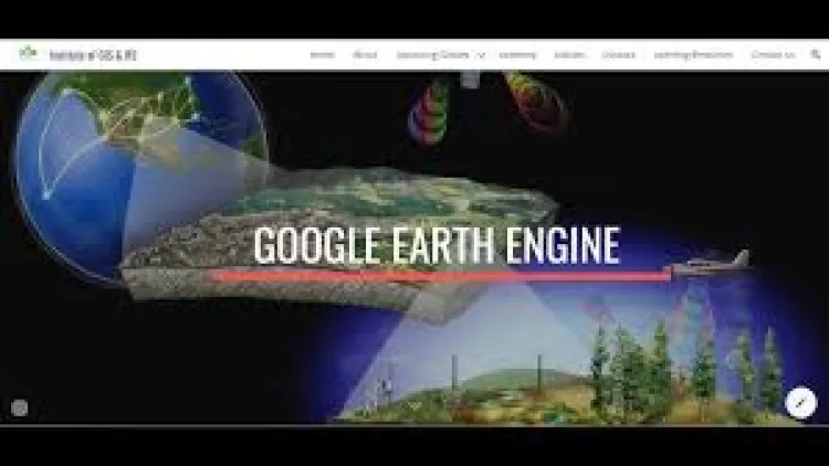
As geospatial data grows in volume and complexity, Big Data Analytics in GIS has become essential for extracting meaningful insights. This Google Earth Engine (GEE) training course equips professionals with the skills to process, analyze, and visualize large-scale geospatial datasets using cloud-based computing. Participants will learn how to harness satellite imagery, climate data, and remote sensing analytics to make data-driven decisions. By integrating big data, machine learning, and spatial analysis, this course empowers learners to tackle real-world challenges in environmental monitoring, land use planning, disaster response, and more.
Curriculum & Topics
9 Topics | 5 Days
-
 Subtopic 1.1:
Overview of big data in GIS and remote sensing
Subtopic 1.1:
Overview of big data in GIS and remote sensing
-
Subtopic 1.2:
Introduction to cloud computing for geospatial analysis
-
Subtopic 1.3:
Setting up Google Earth Engine and navigating the platform
-
Subtopic 2.1:
Importing and processing massive satellite imagery datasets
-
Subtopic 2.2:
Working with vector, raster, and time-series data in GEE
-
Subtopic 2.3:
Cloud storage and data management best practices
-
Subtopic 3.1:
Understanding GEE’s JavaScript and Python API
-
Subtopic 3.2:
Writing and executing scripts for geospatial analysis
-
Subtopic 3.3:
Automating workflows for large-scale data processing
-
Subtopic 4.1:
Accessing and processing Landsat, Sentinel, and MODIS imagery
-
Subtopic 4.2:
Radiometric and geometric corrections of satellite images
-
Subtopic 4.3:
Multi-spectral and multi-temporal data analysis
-
Subtopic 5.1:
Supervised and unsupervised classification techniques
-
Subtopic 5.2:
Detecting land use and land cover (LULC) changes over time
-
Subtopic 5.3:
Applying classification algorithms in GEE
-
Subtopic 6.1:
Introduction to machine learning for GIS applications
-
Subtopic 6.2:
Implementing random forests, decision trees, and deep learning models
-
Subtopic 6.3:
Predictive modeling for spatial trend analysis
-
Subtopic 7.1:
Analyzing climate trends using remote sensing data
-
Subtopic 7.2:
Monitoring deforestation, water bodies, and urban heat islands
-
Subtopic 7.3:
Tracking carbon emissions and land degradation
-
Subtopic 8.1:
Crop monitoring and yield prediction with satellite data
-
Subtopic 8.2:
NDVI and vegetation index analysis for precision agriculture
-
Subtopic 8.3:
Drought assessment and soil moisture mapping
-
Subtopic 9.1:
Building interactive maps and dashboards
-
Subtopic 9.2:
Data visualization techniques for big geospatial datasets
-
Subtopic 9.3:
Web GIS applications with Google Earth Engine