
Programme Overview
Training Description
Who Should Attend
This course is ideal for:
- Geophysicists
- Geologists and geoscientists
- Reservoir engineers
- Petroleum engineers
- Exploration managers
- Petrel software specialists
- Seismic data analysts
- Subsurface modeling professionals
- Oil and gas consultants
- Data scientists in geophysics
- Graduate students in geophysics and petroleum engineering
Session Objectives
- Understand the fundamentals of geophysical interpretation in Petrel
- Process seismic data for interpretation and modeling
- Build and validate velocity models for subsurface imaging
- Interpret horizons and stratigraphic frameworks
- Analyze faults and structural features using seismic data
- Apply seismic attributes for reservoir characterization
About the Course
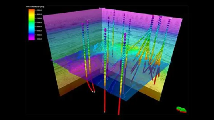
Geophysical interpretation plays a crucial role in reservoir characterization, exploration, and development, providing the insights necessary to make informed decisions in the oil and gas industry. Petrel software offers an advanced platform for integrating seismic data, geological information, and engineering workflows to build accurate subsurface models. This training course focuses on seismic data processing, velocity model building, and advanced interpretation of horizons and faults using Petrel, ensuring participants acquire practical skills that can be applied directly to exploration and field development projects.
The program combines theory with hands-on exercises, enabling participants to process seismic data, generate velocity models, and accurately interpret structural and stratigraphic features. By mastering advanced techniques in seismic visualization, attribute analysis, and fault/horizon interpretation, attendees will be equipped to deliver robust geophysical interpretations that enhance reservoir understanding. The course also emphasizes the integration of velocity models into static and dynamic workflows for improved reservoir modeling and forecasting.
Curriculum & Topics
15 Topics | 10 Days
-
 Subtopic 1.1:
Overview of geophysical interpretation workflows
Subtopic 1.1:
Overview of geophysical interpretation workflows
-
Subtopic 1.2:
Role of seismic data in reservoir characterization
-
Subtopic 1.3:
Integration of geological and geophysical data
-
Subtopic 1.4:
Overview of Petrel geophysics tools
-
Subtopic 1.5:
Case study examples
-
Subtopic 2.1:
Basics of seismic acquisition and processing
-
Subtopic 2.2:
Data quality control techniques
-
Subtopic 2.3:
Noise removal and filtering methods
-
Subtopic 2.4:
Seismic migration principles
-
Subtopic 2.5:
Preparing data for interpretation
-
Subtopic 3.1:
Display options in Petrel
-
Subtopic 3.2:
2D and 3D seismic visualization
-
Subtopic 3.3:
Color mapping and scaling methods
-
Subtopic 3.4:
Volume rendering techniques
-
Subtopic 3.5:
Best practices in visualization
-
Subtopic 4.1:
Introduction to seismic attributes
-
Subtopic 4.2:
Amplitude, phase, and frequency analysis
-
Subtopic 4.3:
Attributes for fault detection
-
Subtopic 4.4:
Attributes for lithology and fluid prediction
-
Subtopic 4.5:
Case examples of attribute workflows
-
Subtopic 5.1:
Role of velocity in seismic imaging
-
Subtopic 5.2:
Building velocity models in Petrel
-
Subtopic 5.3:
Depth vs time conversion principles
-
Subtopic 5.4:
Using well and check-shot data
-
Subtopic 5.5:
Case study on velocity integration
-
Subtopic 6.1:
Layer-based velocity modeling
-
Subtopic 6.2:
Anisotropy in velocity models
-
Subtopic 6.3:
Horizon-constrained velocity building
-
Subtopic 6.4:
Incorporating seismic velocities
-
Subtopic 6.5:
Validation of velocity models
-
Subtopic 7.1:
Identifying key horizons in seismic data
-
Subtopic 7.2:
Manual vs automated horizon picking
-
Subtopic 7.3:
Linking horizons to well data
-
Subtopic 7.4:
Structural and stratigraphic interpretation
-
Subtopic 7.5:
Case studies in horizon analysis
-
Subtopic 8.1:
Principles of fault identification
-
Subtopic 8.2:
Manual fault picking in Petrel
-
Subtopic 8.3:
Using attributes for fault detection
-
Subtopic 8.4:
Fault network modeling
-
Subtopic 8.5:
Visualization of structural features
-
Subtopic 9.1:
Principles of well-to-seismic calibration
-
Subtopic 9.2:
Check-shot and VSP data integration
-
Subtopic 9.3:
Creating synthetic seismograms
-
Subtopic 9.4:
Improving interpretation accuracy
-
Subtopic 9.5:
Case studies on seismic-to-well ties
-
Subtopic 10.1:
Time-to-depth conversion principles
-
Subtopic 10.2:
Velocity model integration
-
Subtopic 10.3:
Depth imaging workflows
-
Subtopic 10.4:
Managing uncertainties in depth conversion
-
Subtopic 10.5:
Practical exercises in depth conversion
-
Subtopic 11.1:
Combining well logs and seismic data
-
Subtopic 11.2:
Cross-plotting techniques
-
Subtopic 11.3:
Enhancing reservoir property interpretation
-
Subtopic 11.4:
Seismic inversion basics
-
Subtopic 11.5:
Practical applications
-
Subtopic 12.1:
Building structural frameworks in Petrel
-
Subtopic 12.2:
Incorporating horizons and faults
-
Subtopic 12.3:
Grid design for structural models
-
Subtopic 12.4:
Linking seismic to reservoir models
-
Subtopic 12.5:
Case examples in structural modeling
-
Subtopic 13.1:
Multi-attribute analysis
-
Subtopic 13.2:
Machine learning applications in seismic interpretation
-
Subtopic 13.3:
Automation in horizon/fault picking
-
Subtopic 13.4:
Quantitative interpretation techniques
-
Subtopic 13.5:
Future of seismic interpretation
-
Subtopic 14.1:
Module 14: Case Studies in Velocity and Interpretation
-
Subtopic 14.2:
Interpretation of complex structural settings
-
Subtopic 14.3:
Lessons learned from field applications
-
Subtopic 14.4:
Peer-reviewed group discussions
-
Subtopic 14.5:
Best practices for project success
-
Subtopic 15.1:
Creating interpretation maps in Petrel
-
Subtopic 15.2:
3D visualization for stakeholders
-
Subtopic 15.3:
Preparing technical reports and dashboards
-
Subtopic 15.4:
Communicating uncertainties in interpretation
-
Subtopic 15.5:
Delivering outputs for reservoir teams